WATER SYSTEM AND SUPPLY
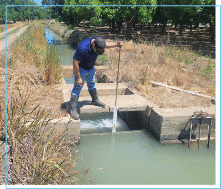
GCID’s Sacramento River water rights were established in 1883, making them some of the oldest in the Sacramento Valley. The District diverts the water at its Hamilton City Pump Station, where it joins the 65-mile-long Main Canal. From there, the water enters a complex system of more than 1,200 miles of canals, laterals and drains serving prime agricultural lands, private habitat lands and federal wildlife refuges.
In addition to its historic water rights, GCID is part of the Sacramento River Settlement Contract with the U.S. Bureau of Reclamation. The contract provides GCID with 720,000 acre-feet of base supply from April to October and 105,000 acre-feet of Central Valley Project water purchased during July and August.
During a designated Critical Year, when natural inflow to Shasta Reservoir is less than 3.2 million acre-feet, Settlement Contractors’ supplies are reduced to 75%. GCID’s total supply is 618,000 acre-feet under those conditions.
The District also has rights under a permit with the State Water Resources Control Board to divert water from November 1 through March 15 for winter flooding for waterfowl, rice straw decomposition and crops.
Water Management Plans
Regional Water Management Plan
The Regional Water Management Plan outlines local water and groundwater resources, sub-basins and district facilities in addition to information about water measurement, pricing and billing policies. The plan also details water management objections and provides progress reports on these objectives.
Agricultural Water Management Plan
The Agricultural Water Management Plan outlines local water and groundwater resources, sub-basins and district facilities in addition to information about water measurement, pricing and billing policies. The plan also details water management objections and provides progress reports on these objectives. This document also contains submittals and approval letters for the plan.
Sustainable Groundwater Management Act
Fact Sheet: The State of Sacramento Valley Groundwater
Groundwater Sustainability Agency Public Hearing Notice
Letter to California Department of Water Resources to Serve as a Groundwater Sustainability Agency
SB88 Compliance
SB 88 Water Diversion Data
The data provided below is provided pursuant to California Code of Regulations Section 933(b)(4). These raw data sets are provided as-is, without any quality assurance and control performed. Therefore, the raw data set may contain erroneous data for numerous and various reasons. These raw data sets are evaluated and reviewed in order to annually report monthly diversions under the pertinent water right(s).
| Diversion | Water Right | Meter ID | Meter Information | Data File |
|---|---|---|---|---|
| Pumping Plant Total Flow | View Data | |||
| Hamilton City Pumping Plant (Stony Creek Meters) | A000018 A001624 A001554 S007367 A030838 | M006153 | Teledyne Acoustic Doppler Flow Meter | View Data |
| Davis Weir (Williams Lift #1) | S007368 | M008326 | Mace Doppler Ultrasonic Insert Velocity Sensor | View Data |
| Drain 55 (Provident Irrigation District) | A030813 A000462 A000640 A000892 | M012018 | Sontek Doppler Side Looker | View Data |

